NR/ESTATES
The estates
Rudna, Macedonia, a townhouse in Timișoara, lands in Romania and a house in Sarajevo: where the family’s property lay, and what became of it.
From Vienna to Bucharest
The estates near Timișoara
- Estate
- City or town
- Area of the Banat map
The places on the maps, with coordinates
- Rudna — Estate — 45.4983, 21.0086
- Macedonia — Estate — 45.5162, 21.0578
- Timișoara — City — 45.7597, 21.2300
- Ciacova — Town — 45.5111, 21.1283
- Žitište — Town — 45.4834, 20.5520
- Osijek — City — 45.5556, 18.6944
- Belgrade — City — 44.8178, 20.4569
- Sarajevo — City — 43.8564, 18.4131
- Vienna — City — 48.2083, 16.3725
- Budapest — City — 47.4925, 19.0514
- Bucharest — City — 44.4325, 26.1039
- Mavrodin — Estate — 44.0364, 25.2383
- Buzescu — Estate — 44.0111, 25.2228
Rudna
Rudna is a village in the commune of Giulvăz, Timiș County, in the Romanian Banat: about 40 km south of Timișoara according to the sources, near the Serbian border, on the right bank of the Timiș. Calculated from the coordinates used on the map, it lies about 34 km from Timișoara in a straight line (conversion by the archive).
A local article of 2026 says that Rudna is first mentioned in 1333 as “Ruda”, had 30 houses in 1717 and more than 1,100 inhabitants in 1880, and had 742 in 2002.
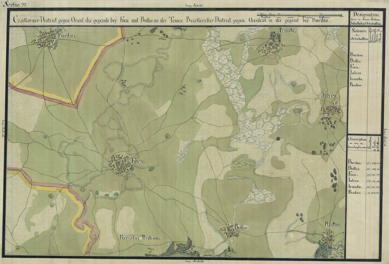
The family bought the estate in 1782 for 52,028 gulden and 22¾ kreuzer; the family page tells how. One local article puts the purchase in 1781.
In 1828 Rudna counted 5,780 jutros of land with 48½ peasant holdings: about 3,300 hectares (conversion by the archive; the units are explained at the foot of this page). In Fedor’s time it was the centre of his domain.
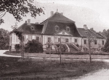
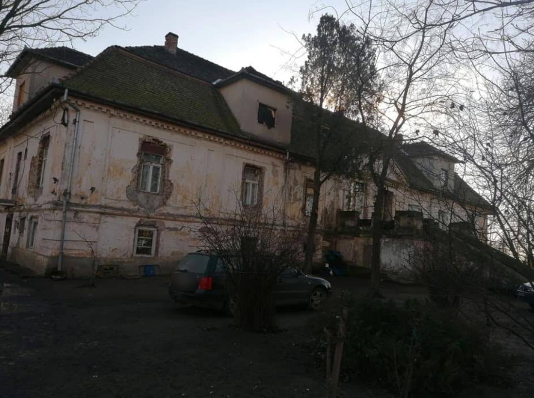
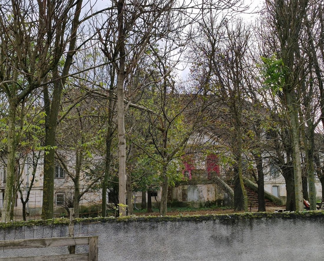
The manor, a kastély (castle) in Hungarian, is dated c. 1780 by heritage sources and to the nineteenth century by other inventories; no builder is named. The earliest picture in the record is a photograph published in 1913: a house of two storeys under a mansard roof, with a pedimented centre and a double flight of steps.
During the Revolution of 1848–49 a fire at the family house near Rudna destroyed the family’s papers from before 1848. The family’s history had to be rebuilt from archives and from the few papers that escaped, chiefly court documents.
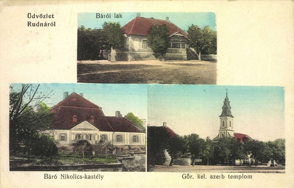
The Serbian Orthodox church of the Holy Archangels Michael and Gabriel was built at Rudna in 1834–38, and local accounts link it to the Nikolić family. It is the third view on the postcard above, “Gör. kel. szerb templom”.
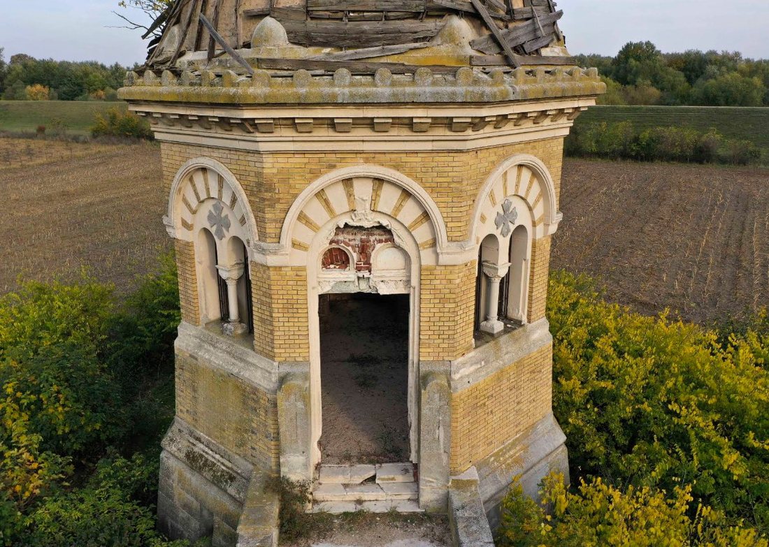
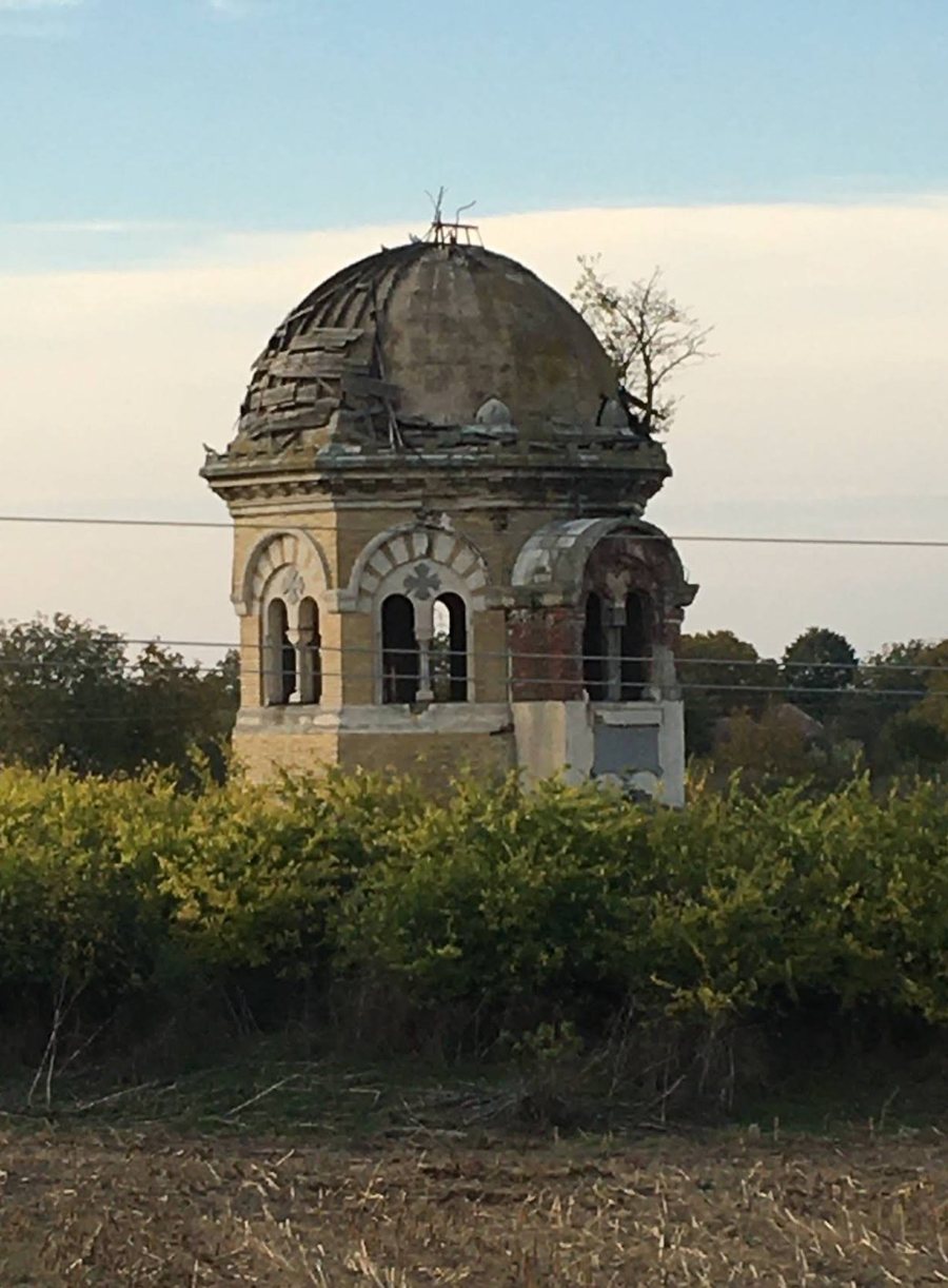
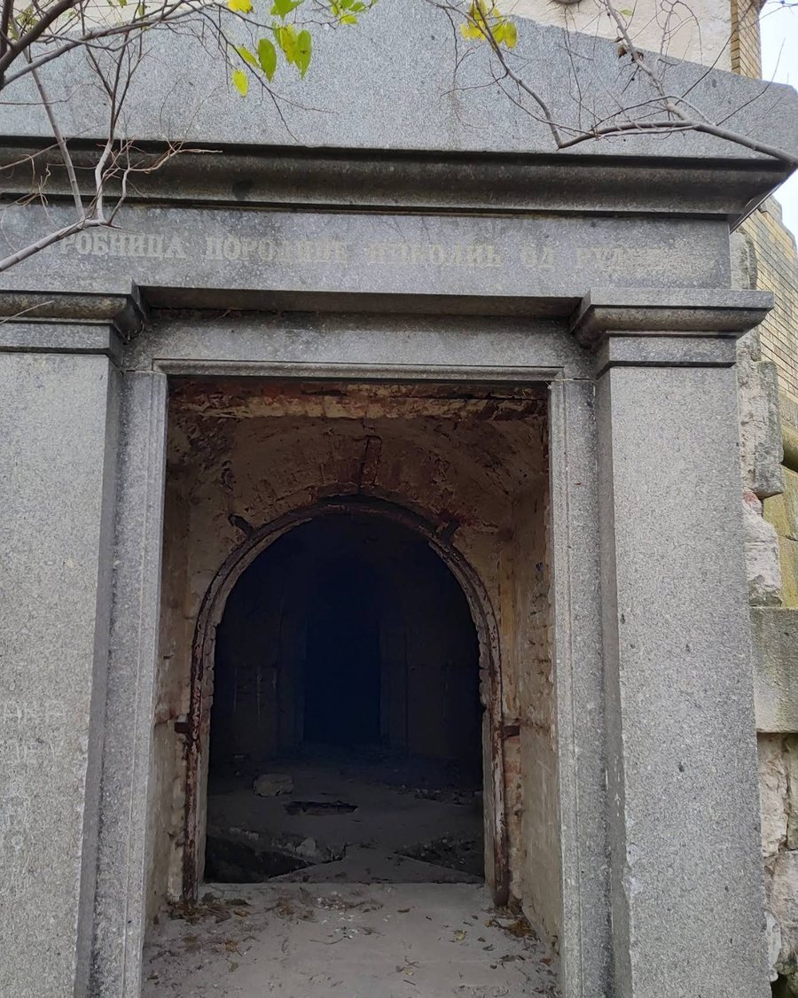
Fedor died on 27 February 1903 in his castle at Rudna. His coffin was carried on 3 March to the Serbian church, which was draped in black, and he was buried on 4 March in the family chapel on the estate. The village had a railway station, and special trains ran for the funeral.
The 1903 reports speak of a family chapel on the estate, the museum paper of a family crypt. Today, the museum paper says, the tomb stands “several kilometres from the manor, neglected”, while a family chapel appears on local visitor tours. The estate was large, about 3,300 hectares, so both can be true.
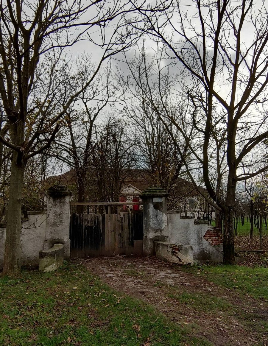
Local press reports that the baron’s son sold the manor in 1919 and that a lawyer, Dr. Alexandru Lighezan, owned it until 1946. It then served as a promenade house and a border-guard post and, in the 1960s, as the headquarters of a collective farm. It decayed after 1989 and has been partly restored since 2002. It is a listed historic monument and remains privately owned. Of the estate buildings a former mill survives; the grounds cover 12 hectares, with a lake and an orchard.
Macedonia
Macedonia is a small village in the town of Ciacova (Čakovo), Timiș County. Jovan Belčić bought the estate in 1825 from the Jovanović-Vidak family. In 1828 it counted 2,000 jutros, about 1,150 hectares, with 62½ peasant holdings, and went to his son Jovan (VII). Mihajlo was born there in 1841. No source consulted describes a manor or other buildings at Macedonia. By the archive’s calculation it lies only about 4 km from Rudna.
Timișoara
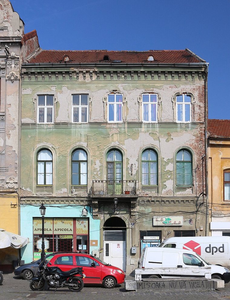
Timișoara (Temesvár) was Fedor’s native city, to which, his obituary says, he remained closely bound. On Piața Traian stands the house of Fedor’s brother, Baron Mihajlo (Mihály in Hungarian): a nineteenth-century town house whose architect and year are not given in the sources consulted. The photograph below was taken in 2020.
The Romanian estates
Fedor inherited estates in Romania from Prince Mihailo Obrenović, his uncle: Mavrodin and Buzescu in Teleorman County, Tămădea-Tămășești in Ilfov County and a quarter of Andrășești. They came to him in the division of the prince’s Romanian property among his heirs, agreed at Bucharest on 8 June 1873. The spellings follow Marcov (2011).
Sarajevo
While Fedor was Civil Adlatus of Bosnia and Herzegovina (1882–86), the former Austro-Hungarian consulate in Sarajevo, a Turkish-style building, was adapted and became the “Nicolics house”, the meeting place of the city’s high society. Micheline was born there in November 1882. Which building it was is not identified.
Units and distances
| Unit | What it is | In this archive |
|---|---|---|
| Jutro (hold) | A measure of land: the German Joch, the Romanian iugăr. About 0.5755 hectare. | Rudna 5,780 (about 3,300 ha). Macedonia 2,000 (about 1,150 ha). Fedor, about 6,360 at the end of the nineteenth century (about 3,660 ha). |
| Session | A peasant’s holding; the manuscript glosses it as a peasant parcel. | Rudna 48½. Macedonia 62½. |
| Gulden and kreuzer | Austrian currency units; the kreuzer is a fraction of the gulden. | Rudna, 1782: 52,028 gulden and 22¾ kreuzer. |
| Distances | Straight-line distances calculated from the coordinates listed with the map. | Rudna to Timișoara about 34 km. Rudna to Macedonia about 4 km. |